I. Relics of the Silk Road: A Millennium-Old Post for Civilization Interchange
Many people are unaware that Keketuohai was already an important node on the Northern Route of the Silk Road in ancient times. In the valleys of the Altai Mountains, the camel bells of merchant caravans and the footprints of envoys were once left behind; silk from the Central Plains and gemstones from the Western Regions converged and circulated here. Since ancient times, this land has been a home where multiple ethnic groups live together, and different cultures have blended and coexisted like the waters of the Irtysh River, planting the cultural gene of inclusiveness here.
It is worth noting that deep in the Altai Mountains, there also live the Tuvan people, known as "the ancient singers at the foot of the snow-capped mountains". They call themselves "people living in the forest", making a living by nomadism and hunting for generations, and still preserving the unique language of the Turkic language family and ancient sacrificial rituals. If you happen to be here during a festival, you can also hear their "kargyraa" (throat singing) performances — this intangible cultural heritage of humanity can produce multiple vocal parts at the same time, and its ethereal sound seems to travel through a thousand years of time.

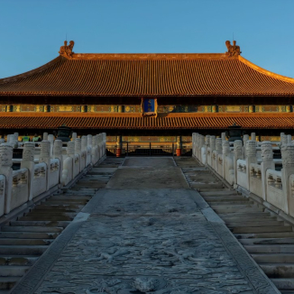
II. Geological Epic: From the "Meritorious Ore Vein" to a World Heritage Site
The mountainous area before your eyes holds the code to the Earth's evolution over hundreds of millions of years. At the end of the Paleozoic Era, approximately 250 million years ago, the Altai Mountains region experienced intense crustal movements and frequent magmatic activities, laying the foundation for the formation of rare metal ore veins. Over the subsequent tens of millions of years, weathering and erosion gradually exposed the underground treasures, ultimately creating Keketuohai's unique geological landscape. What is even more moving, however, is its industrial legend of the past century — from being discovered by geological prospectors in the 1930s to becoming a "hidden contributor" to the industrial development of New China, every piece of ore here carries profound memories of the nation.
Be sure to visit the Geological Exhibition Hall first. This Russian-style building, constructed in 1958, features red brick walls and pointed-top windows that bear distinct marks of the era, making it a rare industrial heritage site in itself. The name of the hall was inscribed by Fang Yi, former Vice Premier of China, who visited Keketuohai in 1980 and put forward important suggestions for the protection and development of the ore veins. Inside the hall, there are three exhibition areas: "Geological Wonders", "Industrial Memories", and "Outstanding Merits", which house nearly a thousand ore specimens and old objects. These include a raw aquamarine stone weighing 50 kilograms, a copper mining lamp used by miners in the 1950s, handwritten ore mining logs, and old photos documenting the transportation of raw materials for China's "Two Bombs and One Satellite" project. Each exhibit tells the glorious past of Keketuohai. Among the most precious exhibits is a piece of "lithium-beryllium stone" from the No. 3 Ore Vein — one of the key raw materials for manufacturing hydrogen bombs. It was relying on countless pieces of such ore that China broke through the nuclear technology blockade in a very short period of time back then.
The most shocking exhibition area in the hall focuses on the "No. 3 Ore Vein". Stretching 2,500 meters long, 1,500 meters wide, and 200 meters deep, this ore vein is rich in 76 kinds of rare metals such as lithium, beryllium, niobium, and tantalum, earning it the title of "Natural Geological Museum" among geologists. During the difficult three-year period (1959-1961), China was under great pressure to repay its foreign debts to the Soviet Union, and the ore from Keketuohai became "hard currency" — at that time, each ton of ore could be exchanged for 800 US dollars. Miners braved the severe cold of minus 40 degrees Celsius, transporting the ore out of the deep mountains using horse-drawn sleds and carrying it on their shoulders and backs. With their youth and sweat, they repaid 40% of China's foreign debt to the Soviet Union. In 1949, a herdsman named Ayigoz accidentally discovered the mine cave while herding. Today, the traces he chiseled back then still remain at the entrance of the ore vein relics. The stacked mining platforms inside the mine pit are like the growth rings of the Earth, recording the transformation process from manual mining to mechanical operation.
[Recommended Core Geological Landscapes]
1. No. 3 Ore Vein Relic
When you visit this "meritorious mine pit" in person, you will be shocked by its scale — this giant concave pit, with a diameter of about 250 meters and a depth of 200 meters, looks like a "giant gem bowl" carefully carved out of the earth when viewed from the observation deck. The dense mouths of mining tunnels on the pit wall are arranged like a honeycomb; in those years, miners went deep underground through these tunnels to mine precious ores. Every morning and evening, when the sun shines obliquely on the pit wall, the metal elements in the ores reflect a faint blue-green luster, coating the mine pit with a mysterious color, making it a must-photograph spot for photography enthusiasts. The scenic area has also set up a "Miners' Sculpture Group" on the edge of the mine pit. The copper miner statues, holding mining picks and carrying ores on their shoulders, vividly reproduce the labor scenes of that era, and many tourists stop here to pay their respects. If you are interested in mining history, you can also participate in the "miner experience activity" in the scenic area: put on retro miner's clothes and a safety helmet, and walk into the shallow mine tunnel under the leadership of a professional guide to experience the working environment of miners back then.

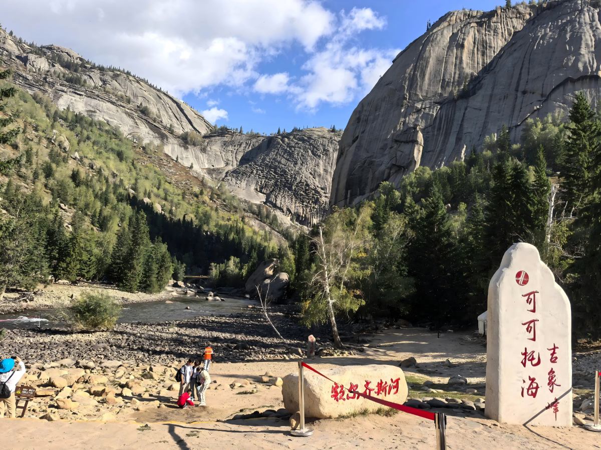
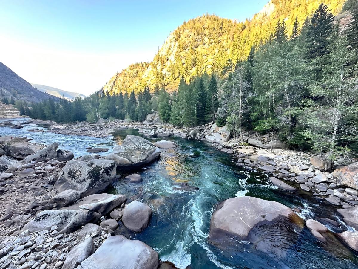
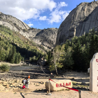
2. Irtysh Grand Canyon
As the "icon of beauty" of Keketuohai, the Grand Canyon stretches for more than 20 kilometers along the Irtysh River and is a typical "granite peak forest landform" — approximately 180 million years ago, underground magma erupted and then cooled to form granite bodies. After tens of millions of years of water erosion and wind carving, the peculiar landscape seen today was finally formed. The granite peak forests on both banks of the river come in various shapes:
The "Flying Stone" is like a huge pebble firmly propped between two mountain peaks, seeming to fall at any moment yet standing firm for thousands of years;
The "Camel Peak" has an outline that closely resembles a camel striding forward with its head held high, even the curvature of the camel's humps is vividly lifelike;
The "Divine Eagle Peak" looks like a giant eagle with outstretched wings, the texture of the wings is clearly visible, and every piece of rock seems to have been carefully carved by nature.
In summer, the river valley is covered with dense spruces and wild flowers everywhere — globeflowers, wild lilies, and forget-me-nots bloom in sequence along the riverbank, forming a colorful sea of flowers. The river water is crystal clear, reflecting the blue sky, white clouds, and mountain peaks; every random shot taken here is a scenic view of desktop wallpaper quality. You can choose to hike or take a shuttle bus to go deep into the canyon:
The hiking trail is about 5 kilometers long, with 3 rest pavilions along the way, suitable for tourists with good physical strength;
The shuttle bus stops at 4 viewing platforms, each offering a different perspective, allowing you to enjoy the canyon scenery from all aspects.
You may also encounter wild animals such as red deer and marmots along the way — red deer often come to the river to drink water in the early morning or evening and will not panic when they see tourists; marmots dig holes on the grassland to build nests, and from time to time they stick their heads out to look around, which is very cute.

3. Divine Bell Mountain
As the iconic landscape of the Grand Canyon, this granite boulder is about 365 meters high, with a diameter of about 150 meters at the bottom and 60 meters at the top. It gets its name because it resembles an inverted giant bell. There is a local legend about its origin: when Genghis Khan marched westward, he stationed his troops here. One night, he suddenly heard a huge bell sound coming from the cliff. He believed this was a warning from heaven, so he ordered his troops to withdraw. Since then, this boulder has been called "Divine Bell". From a geological perspective, Divine Bell Mountain was formed when a granite body was cut by two vertical faults and then underwent long-term weathering and erosion, eventually becoming an independent stone peak. Its rock walls are smooth and steep, with almost no vegetation coverage — only a small amount of lichen forms faint yellow-green streaks on the rock surface. In the early morning, when the sun rises from the east and shines on the "bell", it presents a gradient effect from golden red to orange-yellow. Paired with the river and forest at the bottom of the valley, it forms a stunning landscape painting of mountains and waters. In the rainy season, waterfalls appear on the rock walls; the water flows down the rock surface, like putting a layer of white yarn on Divine Bell Mountain, creating a unique charm. The scenic area has set up an observation platform at the foot of Divine Bell Mountain, where you can take photos as a souvenir, or walk along the wooden plank road to the river to feel the grandeur of the boulder up close.
III. Living Folklore: A Portrait of Kazakh Pastoral Life
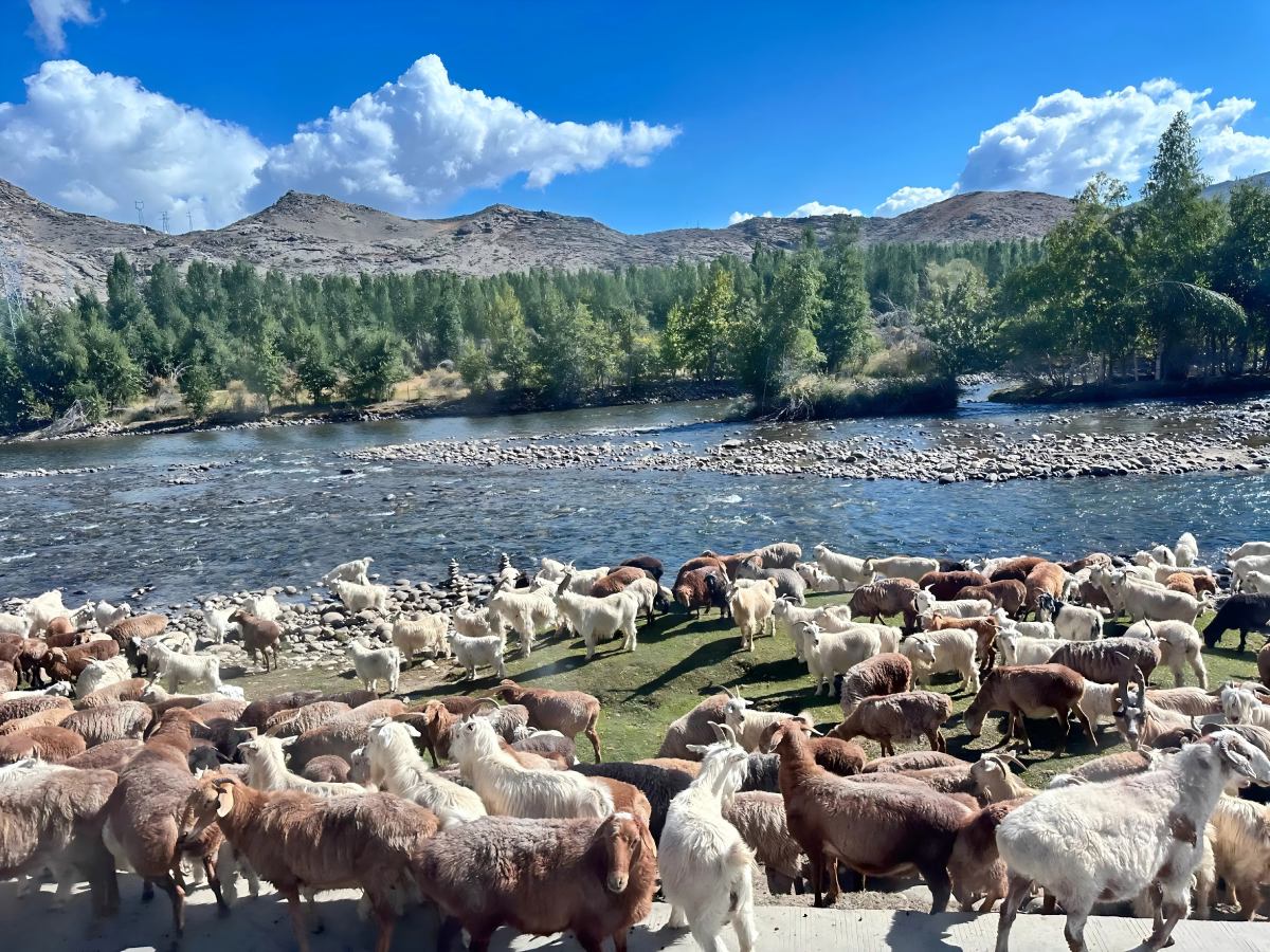
Venturing into Talat Village in Keketuohai is like stepping into a living scene of Kazakh daily life. Nestled at the source of the Irtysh River, this village sits at an altitude of approximately 1,200 meters, surrounded by grasslands and forests. Here, 184 Kazakh households have lived for generations, preserving the most authentic nomadic culture. With a history of over 2,000 years, the Kazakh people originally inhabited the Central Asian steppes. After the 13th century, they gradually migrated to the Altai Mountains, making a living through nomadism and hunting, and developing a unique cultural system. In Talat Village, you can not only see traditional yurts, horse whips, and dombras but also participate in the Kazakhs’ daily life firsthand, experiencing the wisdom and warmth behind their "following water and grass for survival" lifestyle.

[Three Core Cultural Essences]
1. Horseback Culture
Known as the "nation on horseback," the Kazakhs share a deep bond with horses. In the past, horses were essential for herding, transportation, and hunting, and even served as a measure of wealth (a local saying goes, "The rich are judged by their horses; the poor by their sheep"). Today, although cars and motorcycles have become common, horseback culture remains a spiritual symbol of the Kazakh people.
In Talat Village, you can watch villagers skillfully herd sheep on horseback: in the morning, men ride horses to drive sheep to the grasslands, and the crisp crack of their whips echoes through the valleys; in the evening, they ride back with sheep, and wild fruits and herbs collected during the day are loaded on horsebacks. The village also holds regular horse racing and kokpar (sheep-snatching) events, which are full of power and grace. For horse racing, riders are mostly teenagers aged 10-15, dressed in bright ethnic costumes, galloping across the grasslands on saddleless horses at speeds of up to 60 km/h. Kokpar is a competition for adult men, where they ride horses to fight over a sheepskin—requiring balance and skill to fend off opponents, creating a fierce and spectacular scene.
If you want to try horseback riding, villagers will select a gentle horse for you. Most of these horses are professionally trained, making them easy to handle even for beginners. Under the guidance of a professional, you can ride along the grasslands around the village, enjoying a bird’s-eye view of the magnificent river valley: the green grassland spreads like a carpet, dotted with white yurts, and the Irtysh River winds like a blue ribbon—leaving you feeling refreshed and relaxed. After the ride, villagers will offer you kumis (fermented mare’s milk), a tart-sweet drink that relieves fatigue and is a treasured Kazakh hospitality offering.

2. Culinary Wisdom
Kazakh food culture is a product of nomadic life. In the past, frequent migration across grasslands required food that was easy to carry and energy-rich, leading to a diet centered on meat, dairy, and grains.
In Talat Village, be sure to try hand-grabbed mutton made from Altai fat-tailed sheep. Raised on the Altai grasslands, these sheep feed on Chinese medicinal herbs, wild onions, and garlic, and drink mountain spring water—resulting in tender, non-gamy meat. Cooked with only water and salt for two hours, the mutton is served with a sprinkle of shredded onions; a bite releases rich juices, offering pure deliciousness even without seasonings.

Other must-tries include uzbek (fried dough twists) and boorsak (fried dough puffs), both handmade by Kazakh women. Uzbek is made by twisting thin strips of dough into rings and deep-frying them—crisp and tasty on its own or soaked in milk tea. Boorsak is small pieces of fried dough eaten with honey or jam, sweet but not cloying. For dessert, try zhenat, a "treasured hospitality dish" made from tarmi (a type of broomcorn millet). Steamed tarmi is mixed with yogurt, butter, and raisins—soft, sweet, rich in protein and vitamins, and perfect for relieving summer heat.
Some homestays offer a "learn to cook with herders" experience: you can step into a villager’s kitchen, knead dough and fry uzbek with the hostess, and learn the secret to making Kazakh milk tea—boil brick tea to make a strong brew, add fresh milk, bring to a boil, skim off the foam, and add a pinch of salt for a mellow cup of tea.

3. Festivals & Songs
Eid al-Adha is the most important Kazakh festival, equivalent to the Spring Festival of the Han people, usually falling on the 10th day of the 12th month in the Islamic calendar. If you visit during this time, Talat Village will be filled with joy:
A few days before the festival, villagers start preparing—men go to markets to buy new clothes and gifts, while women clean their homes and make festive food.
On the festival morning, the whole village goes to the mosque for prayers, wishing for peace and happiness.
After prayers, celebrations begin: men slaughter sheep to treat guests. Following Kazakh tradition, the sheep’s head is presented to the most respected guest, who first gives the sheep’s eyes to children (symbolizing "helping children see the world clearly") and the ears to young people (symbolizing "urging youth to listen to elders’ teachings"). Women serve a feast of hand-grabbed mutton, uzbek, and zhenat, filling the air with delicious aromas. Children in new clothes chase each other in courtyards, singing cheerful folk songs from time to time.
The highlight of the festival is the dombra playing and group dancing. The dombra, a traditional Kazakh plucked string instrument with a pine body and two strings, produces rich melodies; players sing epics while playing, telling Kazakh history and legends. The group dance kara zhorga (black horse dance) is full of energy—people of all ages form a circle, stamping their feet and turning in time with the dombra, and even tourists can easily join in.
Even outside festival seasons, the village’s cultural square hosts regular mini-folk performances. Every Saturday afternoon, local folk artists gather here to perform dombra playing, throat singing, and eagle dances, allowing you to experience Kazakh art anytime. The most spectacular is the eagle dance—dancers mimic an eagle spreading its wings, circling, and diving, moving in time with the dombra, as if a real eagle is soaring on stage, showing the Kazakhs’ reverence for nature.

[Must-Try Activities Around the Village]
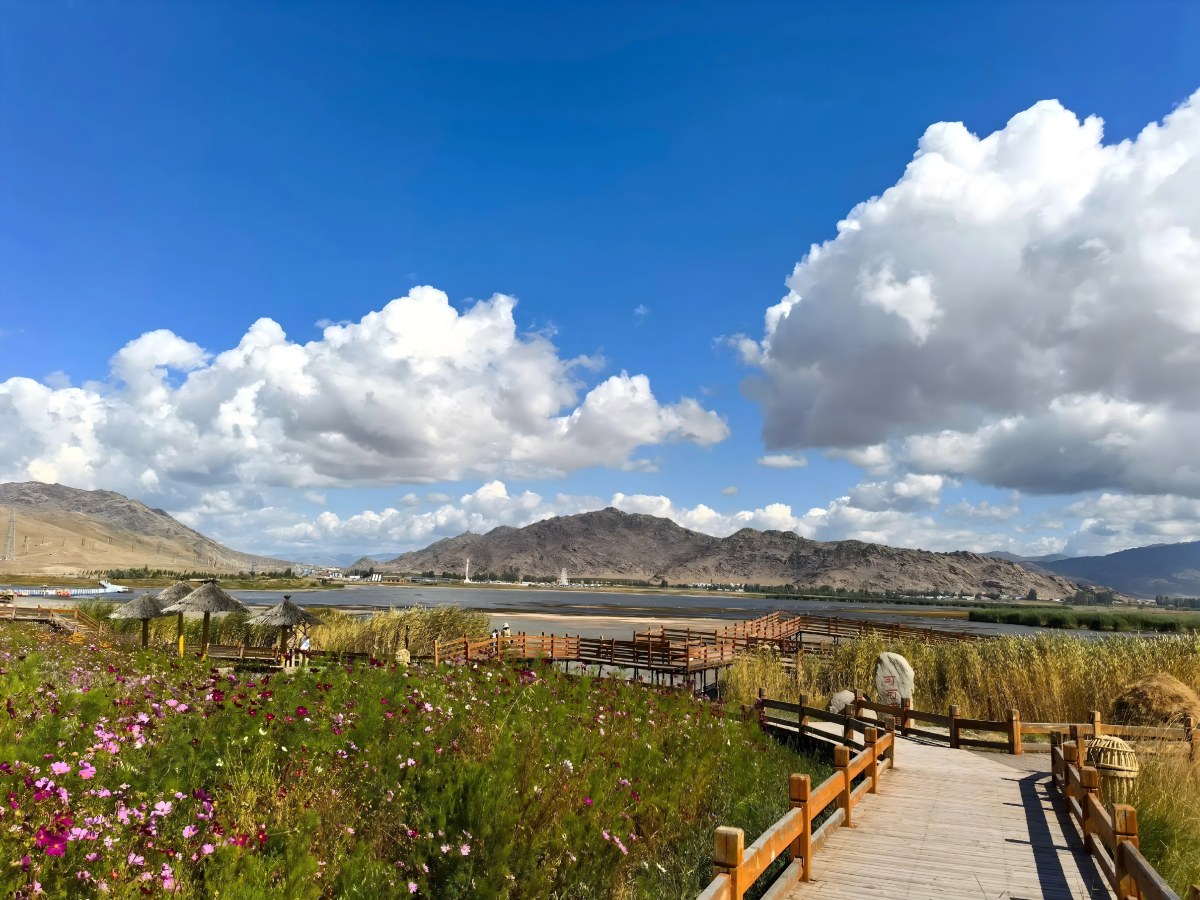
• Irtysh River Rafting
Start from the rafting point near Talat Village, and drift downstream on an inflatable raft for about 8 kilometers, taking 1.5 hours. The route passes through different sections such as shoals, rapids, and bends—offering calm waters for sightseeing and thrilling rapids for an adrenaline rush.
The scenery along the way is stunning: on the left, green grasslands stretch out, with cattle and sheep grazing leisurely; on the right, dense spruce forests stand, and you may occasionally see red deer walking out of the woods to drink by the river. During the trip, guides will share facts about the Irtysh River—it is China’s only river that flows into the Arctic Ocean, originating from the southern foot of the Altai Mountains, with a total length of 4,248 kilometers (546 kilometers within China) and is known as one of Xinjiang’s "mother rivers."
After rafting, the scenic area provides hot water and ginger tea to keep you warm. If you’re lucky, you may spot wild swans by the river—they come here every summer to breed, and their white figures stand out against the blue water.

• Grassland Starry Sky Camping
In summer, the grasslands around Talat Village are perfect for stargazing—with high altitude, thin air, and no urban light pollution, visibility is extremely high. You can set up a tent in the homestay’s camping area or rent a traditional Kazakh yurt.
As night falls, look up to see the bright Milky Way stretching across the sky, with stars seeming within reach. Occasionally, meteors streak across the night, inviting you to make a wish. The camping area also hosts "starry sky evenings": villagers light bonfires, play the dombra, and sing folk songs; tourists can dance around the fire, chat, and enjoy roasted mutton and kumis.
Late at night, lying in the tent, you can hear the wind blowing across the grasslands, the chirping of insects, and occasionally the barking of a herder’s dog in the distance—a tranquility and comfort you can never find in cities. If you’re interested in astronomy, you can borrow the scenic area’s astronomical telescope to observe lunar craters and Saturn’s rings, marveling at the vastness and magic of the universe.


V. An Unforgettable Date Across Time
Dear friends, as our Keketuohai journey is coming to an end, we believe this land has left a unique mark in your heart—perhaps it’s the ore glowing with national pride in the No. 3 Ore Vein, the stunning landscape of the Irtysh Grand Canyon, the warm smiles of Kazakh villagers in Talat Village, or the bright Milky Way within arm’s reach under the grassland’s starry sky.
Keketuohai is never just a scenic spot; it is a natural epic written by hundreds of millions of years of geological changes, an industrial legend forged by the sweat of several generations, and a spiritual home carrying the integration of multiple ethnic cultures. Here, every rock tells a story of history, every folk song conveys warmth, and every encounter is full of surprises.
Whether you take home a hand-polished gem specimen, a handmade dried milk cake given by a herder, or vivid memories in your mind, we hope this beauty from the foot of the Altai Mountains will become a warm part of your future recollections.